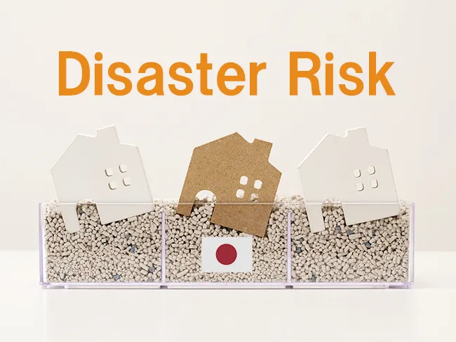
(Why ground, water, and tsunami risks matter more than the floor plan)
Buying a home in Japan can be exciting — but smart buyers look beneath the surface, literally.
Japan’s unique geography and climate mean that three natural forces deserve your full attention before signing any contract:
- Ground stability (earthquake & liquefaction)
- Water and river flooding (heavy rain & overflow)
- Tsunami risks (especially near coasts and river mouths)
Japan is an earthquake country and, increasingly, an intense-rain country.
In fact, there are about 2,000 noticeable earthquakes a year — roughly five every day.
Add to that stronger typhoons and rising sea levels, and it’s clear that location and ground conditions are not just background details — they define your home’s safety and long-term value.
1) Ground: what to watch for (and why it matters)
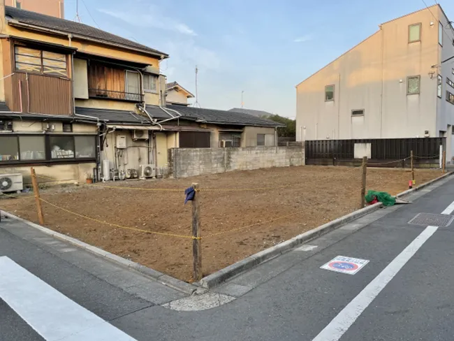
Why: during earthquakes, soft or reclaimed ground can liquefy, making even new houses tilt or crack.
Areas built on reclaimed land, filled valleys, or soft alluvial plains are the most vulnerable.
Ground types to avoid

- Reclaimed coastal or riverside land (e.g., Tokyo Bay, Osaka Bay areas)
- Loose sandy or silty soil with shallow groundwater
- Low-lying alluvial plains
- Artificial slopes without solid retaining structures
Ground types to prefer
- Natural terraces and plateaus (e.g., Musashino Plateau in western Tokyo)
- Bedrock or dense compacted soil
- Areas where soil improvement (piling, compaction, replacement) has been done
How to check the ground
- Ask for a geotechnical report or building permit soil data
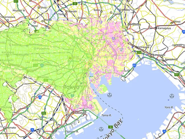
- Use your city’s liquefaction map (Tokyo, Yokohama, etc. publish PDFs)
- Check foundation type: pile foundations usually indicate weak ground compensated by engineering
- Search Japan’s Geological Information Portal for local soil data
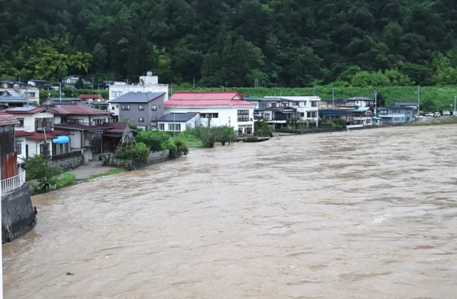
2) Water & Rivers: increasing flood risk
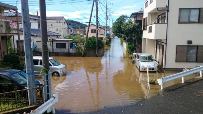
Heavy rain and river overflow have become Japan’s most frequent natural disaster in the past decade.
Even inland areas can flood after hours of record rainfall.
What to watch for
- Properties near rivers or in low-lying basins (especially Arakawa, Tone, Kinu, and Edo Rivers)
- Riverbank erosion and “backwater” flooding from overwhelmed drainage systems
- Urban flash floods from overwhelmed sewers during typhoons
What’s considered dangerous?
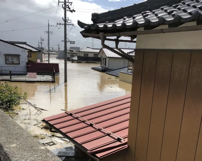
Flood hazard maps show potential inundation depths — even 45 cm (1.5 ft) of flooding can cause severe damage.
There’s no fixed “safe distance” from rivers; instead, check:
- Your address on the MLIT Flood Hazard Map Portal
- Your property’s elevation compared to nearby rivers
- The local government’s maximum inundation depth scenario
Safer examples
- Western Tokyo (Musashino, Mitaka, Setagaya terraces) = higher ground, less flood-prone
- Be cautious in low-lying wards (Koto, Edogawa, Ota) — many are reclaimed and below river level
3) Tsunami: coastal and river-mouth risk
While floods and earthquakes are frequent, tsunamis are rarer — but far more destructive when they strike.
Japan’s 2011 Tohoku earthquake showed that even “protected” coastal areas can face catastrophic inundation.
Tsunami waves can also travel inland through rivers, flooding areas that aren’t directly on the coast.
Where tsunami risk matters
- Pacific coastal regions (Tohoku, Shizuoka, Wakayama, Kochi, Miyazaki, Okinawa)
- Tokyo Bay, Osaka Bay, and Nagoya coastal zones — though levees exist, maps still mark potential inundation
- River mouths and canals connecting inland cities to the sea — tsunamis can run upstream several kilometers
How to check tsunami danger
- Use Japan’s official Tsunami Hazard Map Portal (available through MLIT and local municipalities):
👉 MLIT National Land Numerical Information – Tsunami Inundation Map (English interface) - Look at the “expected tsunami inundation depth” and “time until arrival” layers
- Choose properties above 10 meters elevation when possible — tsunami hazard maps often mark this as the “evacuation safe zone”
- Ask the local city office for evacuation route maps and designated tsunami shelters
Quick checklist for tsunami risk
| Risk factor | What it means | What to do |
|---|---|---|
| Property within 1 km of coastline or major river mouth | Potential inundation zone | Check tsunami map and elevation |
| Elevation below 10 m | May be within wave reach | Prefer lots above 10 m or on higher terraces |
| No visible seawall or located behind reclaimed embankments | Higher exposure risk | Confirm levee height and maintenance |
| Within “blue” or “red” area on hazard map | Indicates predicted tsunami reach | Avoid or prepare elevated evacuation routes |
Combined checklist
| Topic | Watch out for | Prefer / Look for | Action |
|---|---|---|---|
| Ground | Reclaimed or filled land, soft soil, high groundwater | Natural terraces, bedrock, compacted ground | Check liquefaction map, ask for soil report |
| Flood / Rivers | Low-lying floodplains, near large rivers, hazard map shows >0.45 m inundation | High elevation, good drainage, outside main flood zones | Use MLIT flood map, confirm floor level |
| Tsunami | Coastal or river-mouth areas below 10 m elevation | Inland or elevated areas (≥10 m above sea level) | Check tsunami hazard map, confirm evacuation route |
Useful links
- 🌐 MLIT Flood and Tsunami Hazard Map Portal (English)
https://disaportal.gsi.go.jp/hazardmap/ - 🗾 Tokyo Liquefaction & Ground Stability Maps (Tokyo Metropolitan Government)
https://www.bousai.metro.tokyo.lg.jp - 🏡 Geospatial Information Authority of Japan (GSI) — National hazard layers for all prefectures
https://disaportal.gsi.go.jp
Final advice
- Always verify your exact address on hazard maps — don’t rely on “the neighborhood seems fine.”
- Check both elevation and inundation depth — they can differ dramatically within a few hundred meters.
- Remember: some “brand-new” homes are built on risky land simply because the lot was cheap.
Buying safely in Japan isn’t about luck — it’s about reading the ground, the water, and the coast.
When I bought my current house, I also checked the ground conditions and reviewed the local flood hazard map before making the decision. For people from countries with few natural disasters, this might sound excessive — but for Japanese people, it’s simply common sense.
Thanks for reading!
You can find great-value tours, experiences, and tickets in Japan here.